
Return of the Floods: North Queensland During The 2025 Wet Season
1/02/2025
It’s the first day of February. I’ve woken up after a deep sleep. One of the best I’ve had in a while, made more calm with the rain on the tin roof. Then, I checked my phone, and the situation seems to have escalated. The texts I’ve been getting from the Townsville Disaster Group have changed. At 11:36AM, they issued that “Cluden, Hermit Park, Idalia, Oonoonba, Railway Estate and Rosslea. Dangerous flooding is expected in the next 24hrs. You must PREPARE TO LEAVE.” This is a departure from the previous “PREPARE TO LEAVE if you experiencing flooding & feel unsafe.”
So alas, I’ve broken out the log again. Time to see where this goes. My house has become a bunker. Away we go!
Yesterday was quite a peaceful day, the ECG I had just before floodwaters started turned up had a good result. I was feeling pretty good.
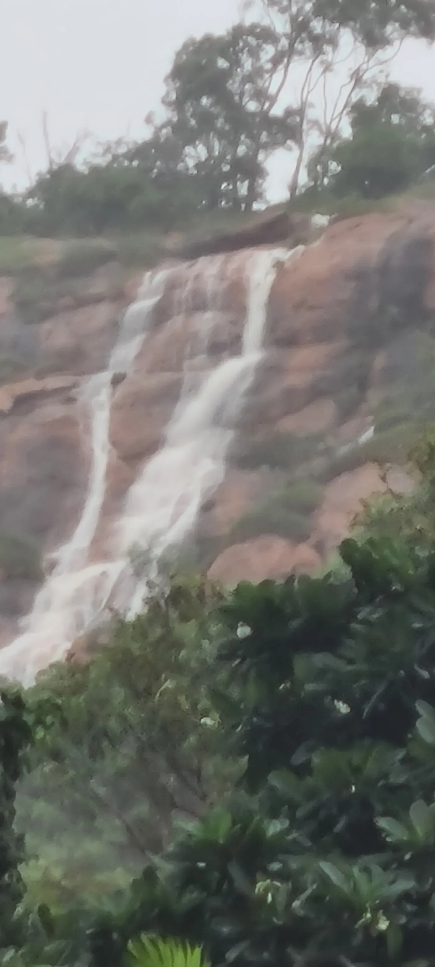
Here’s how you can tell when we get our fair share of rain… If you look at Castle Hill from the Strand, there is a cliff face to the left. From it will run twin waterfalls. Two white ribbons of water that form from little waterways near the end of the Goat Track, down to the storm drains and out to sea. However, as I can still see now, these waterfalls are much larger.
By 3:20PM, it felt like things had indeed escalated. The trees outside were no longer still — they were flowing and whooshing like stormy waves breaking on a beach, their limbs caught in the rhythm of something older and more powerful than wind. They swayed back and forth with slow, sweeping motions, like sea anemones underwater, bending with invisible currents that pulsed through the air.
The rain hadn’t let up. If anything, it had found new determination, sweeping across the streets in long silver streaks, hammering the rooftops and flattening the grass. Gusts of wind howled between the houses with the voice of something wild and watchful.
Inside, I could feel the pressure tightening — not just the weather, but the knowledge. The steady tick of time dragging us closer to something we couldn’t fully see yet. My phone buzzed on the table, another alert, another reminder.
There was a calm before the storm, yes — but this wasn’t it. This was the storm learning to breathe.
This again feels like the episode of The Goodies, when they were maintaining a lighthouse during a rough storm and the lamp burst, forcing them to get comically creative to warn the incoming ships. Yes, that was my honest analogy for that time. The late Tim Brooke-Taylor’s performance of panicked shouting and whimpering was especially memorable then. His passing later on only made this moment more of a special memory. He will be remembered by me, and many others.
I consult the emergency management dashboard… The Townsville Local Disaster Management Group (TLDMG) has moved to Stand Up and is continuing to monitor the ongoing weather event. Stand Up is the operational state following ‘lean forward’ whereby resources are mobilised, personnel are activated from agencies such as TCC, QPS, QFD, SES and operational activities commenced. TLDMG is activated with the LDCC being activated. They ask community members to stay informed by monitoring this dashboard, listening to local radio, and checking their emergency plan and kit.
Latest news published by Townsville City Council also include river and beaches closed. Residents at Cluden, Hermit Park, Idalia, Oonoonba, Railway Estate and Rosslea must prepare to leave.
There’s also a map. A Pink Zone covers most of the south, along the Dalrymple Road, parts of Thuringowa, Garbutt, West End and the CBD. Meanwhile, there’s a Black Zone along the Ross River, and covering the aforementioned suburbs that must prepare to leave.
Still, I got stuff to look forward to. Within Temptation is coming to Brisbane around the same time I’ll be down there for Alestorm, and the new season of Invincible debuts on Thursday.
The rest of the day was drinks, per the Friday tradition, alone on the balcony, since my parents were out. With the escalating rain, takeaway wasn’t viable, so it was dinner to the tune of the Sports Bizarre podcast and binging of TheExpanse and the Warcraft movie.
My mate David called. Looks like our binging at my place isn’t on today. He updated me on a few things during our chat. Bayswater Road is closed. Railway Estate is being evacuated. The one good thing that came from 2019 floods was an updated flood map.
This night. I’ve dealt with a home invasion of ants. The large kind. Had to precipitate a small massacre with my spray, a thong and the vacuum cleaner, which took care of most of them. Had a little Evil Dead moment with them. Then I had a pile of spaghetti and slop that was apparently chicken fettucine.
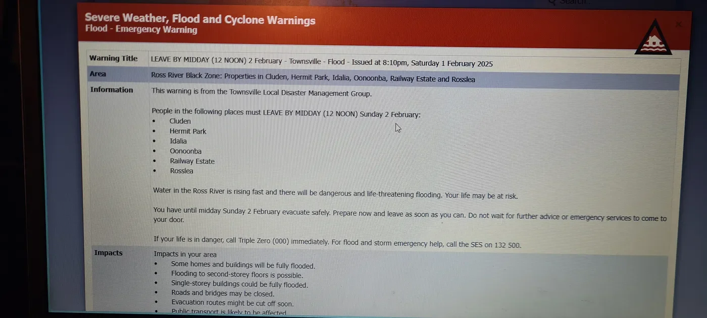
When chatting with Dad, I noticed a new text that read: “Emergency Warning — Cluden, Hermit Park, Idalia, Oonoonba, Railway Estate & Rosslea. Dangerous flooding will occur. LEAVE BY MIDDAY SUN 2 FED to evacuate safely.”
Now that’s quite an escalation. This might be a sequel to the 2019 Townsville Floods after all. That’s a pretty large bit of territory to evacuate. I’ve offered my high ground on Facebook, saying I have a big empty house.
The rain continues, flowing freely likes waves in the sky.
02/02/25
The situation has escalated still…
Authorities have warned that this could be worse than 2019. That is alarming indeed.
One person is deceased after an emergency services boat flipped in floodwaters in north Queensland, where a disaster continues to unfold. Multiple areas have now had more than 500 millimetres of rain since Saturday morning, on top of already soaking falls since Friday. Burdekin, Cairns, Palm Island and Townsville councils will also receive disaster assistance to help undertake counter disaster operations, emergency road repairs, and the reconstruction of essential public assets.
There are more than 2,000 properties without power in the Townsville region, and Premier Crisafulli said the substation in Ingham would be cut off. “That means there will be significant power outage for that community, and that power outage will be off for some time,” he said. The Premier said there was a “prospect of record rainfall”, comparing the situation in Ingham to the record-breaking flood of 1967.
“The Herbert reached 15.2 metres in that flood, it’s currently at 14.89m and rising — it’s expected to reach similar levels to 1967 at some stage during the day,” he said. “If you are in harm’s way, we’re asking residents to please seek safety.”
Residents of Townsville’s “black zone” suburbs were given until midday today to evacuate as the threat of life-threatening flooding continues to rise. The affected suburbs — Cluden, Rosslea, Railway Estate, Stuart, and Oonoonba — remain under emergency orders.
Townsville Councillor Andrew Robinson reported that most residents had already evacuated, while other areas remain under a “watch and act” alert. “Even if you are not in one of those zones, we’re asking people to stay alert,” Robinson said.
The Townsville Airport has been closed, with passengers scheduled to fly on Sunday or Monday advised to check the airport’s website for updates. Meanwhile, Townsville University Hospital has cancelled all elective surgeries, though it remains open. The CEO noted an increase in emergency department visits, warning that non-urgent patients may face longer wait times.
The Queensland Police Superintendent stated that authorities are preparing for severe flooding, with further evacuation orders likely as conditions worsen. The Hinchinbrook Shire Council issued an emergency alert at 4:30am on Sunday, urging residents to seek shelter. With river catchments from Cairns to Mackay already at capacity, officials believe today could be a critical turning point.
The SES Northern Region Director said the majority of requests for assistance in Townsville have been related to sandbagging and leaking roofs. He also noted that many homes still had tarps on their roofs from Tropical Cyclone Kirrily, leaving them particularly vulnerable. “This could be a three-to-four-week marathon, it’s not a sprint.”
Rainfall totals have been extreme, with Paluma Dam recording 712mm in just 24 hours, Rollingstone receiving 639mm, and Bluewater experiencing 378mm of rain.
The Bureau of Meteorology said north Queensland is now facing a “flood disaster.”
“We’re still likely to see at least another widespread 100mm to almost 200mm in the warning area, on top of what we’ve already seen,” he said. “We could even see isolated falls in excess of 400mm or 500mm as well in the next 24 hours. Unfortunately, a lot more rain to come, and major flooding will continue to impact many rivers, creeks and streams and flash flooding as well. Everything’s just so saturated now.”
Indeed… Outside the house, North Ward is covered in an almost ethereal grey mist. The rain seems to be lighter than it was last night, but the wind continues its series of squalls. The little tree in a pot on the balcony that Dad had been working on had managed to blow over and tumble down the stairs, which was a sad sight.
I must hear what local radio’s saying…
As expected, authorities have issued a call to move to higher ground, warning that lives and property may be at risk. Elective surgeries scheduled for tomorrow at Townsville University Hospital have been cancelled, with the hospital’s chief executive confirming that patients with urgent procedures will be contacted directly. Power has been cut to more than 2,000 properties across North and Far North Queensland, with most outages occurring in Townsville. Amid the emergency, Ergon Energy reported that one of its vehicles had been stolen in Townsville. While the vehicle has since been recovered, the situation is deeply disappointing. “We have an urban crew out there working to restore power and keep the community safe, and yet their vehicle was stolen. It just means we have one less resource to respond,” an Ergon spokesperson said.
A severe weather warning remains in effect for heavy, locally intense rainfall and damaging winds over Northeast Queensland. Heavy rainfall, which may lead to flash flooding, is forecast between Tully and Ayr, extending inland to the far eastern Northern Goldfields and Upper Flinders. Additionally, locally intense rainfall, capable of causing dangerous, life-threatening flash flooding, is possible between Cairns and Townsville. Isolated to scattered showers and thunderstorms are expected across most of the state tomorrow.
ABC Radio QLD’s “The Drive” with Adam Stephen is providing emergency coverage. With the devastating 2019 Townsville flood still fresh in memory, it’s hard to believe we’re back here so soon. Statistically, the 2019 event was considered rare, yet we could be facing another flood of similar magnitude. At this stage, it is difficult to predict the full extent of the situation.
The Herbert River remains in an especially dire situation. For the Haughton River, authorities predict that flood levels will approach those recorded in March 2018, with major flooding already occurring along the river, mirroring the 2018 event. Hourly updates will continue throughout the afternoon as part of ongoing emergency coverage. In situations like cyclones or major floods, real-time monitoring is essential — we will be tracking the rising river levels and the movement of the tropical low off the coast hour by hour.
A thunderstorm warning has been issued for intense rainfall, with Paluma particularly affected. In the past 48 hours, the area has received significant rainfall, including 70mm in just one hour earlier today adding to the already heavy accumulation recorded by 9:00 AM this morning.
All schools in Townsville and the Hinchinbrook local government areas will be closed tomorrow due to localized flooding. Several schools outside these areas will also be closed. Residents in flood-affected areas are urged to prioritize their safety. The Insurance Council of Australia (ICA) has just declared this a significant event for North Queensland. The ICA’s preliminary catastrophe processes have been activated, allowing insurers to assess the impact. The most severe flooding has affected communities around Townsville, Innisfail, Ingham, Gordonvale, and Cardwell, though all flood-impacted regions in North and Far North Queensland since January 29 fall under this declaration. This remains an unfolding weather event.
There is serious concern about flooding in the lower reaches of the Ross River, particularly as the next high tide approaches.
The rainfall across Northeast Queensland has been truly incredible, with some areas exceeding 1,000 millimetres of rain. Given these extreme totals, it’s no surprise that dangerous and major flooding is impacting many communities, including Townsville and Ingham. The severe weather warning remains in effect, and heavy rainfall is expected to continue for at least the next 18 to 24 hours.
A severe thunderstorm warning has just been issued, particularly affecting Paluma, where rainfall intensity has been extreme. Currently, heavy rainfall is concentrated north of Bluewater, stretching up toward Rollingstone and the Bruce Highway. Strong winds are converging along this portion of the coastline, creating extremely dangerous and life-threatening flash flooding risks, especially in Paluma and Rollingstone.
To give a sense of the sheer volume of rainfall: Paluma has recorded almost 180mm in the past three hours, totalling 280mm since this morning. North of Bluewater to Ingham, many areas have received over 150mm. South Townsville has recorded 69mm since 9:00 AM, while Townsville Airport has recorded 65mm.
The most immediate concern is the ongoing heavy rainfall pushing down toward Magnetic Island and Townsville this afternoon. Converging storm bands from the Coral Sea are forming intense rain trains, stretching from Dunk Island to Charters Towers.
A critical development is that Bluewater Creek has now hit major flood levels. This is new information added to the severe thunderstorm warning, emphasizing the risk of catastrophic flash flooding due to a particularly severe thunderstorm cell over Paluma. Given the area has already been inundated with rain, any further downpours will exacerbate the situation significantly.
There is certainly a long list of warnings, underscoring the dangerous and potentially deadly nature of this weather system. Right now, we must focus on the immediate situation, which remains extremely hazardous. The pressure system off the coast continues to bring torrential rainfall to an already saturated coastline. Over the past 48 hours, some areas have recorded extraordinary rainfall totals.
A severe thunderstorm warning has just been issued for intense rainfall over Paluma, with 173mm falling in just three hours before 2:00 PM today. A severe weather warning remains in effect for heavy, locally intense rainfall and damaging winds from Tully to Ayr, potentially continuing into early next week. Rainfall totals could reach up to 450mm in 24 hours between Tully and Ayr and inland to the Northern Goldfields and Upper Flinders, including Charters Towers. Mount Garnet residents have reported ominous black storm clouds rolling in. Rainfall in the Ravenshoe and Mount Garnet area is a serious concern, as this region forms the upper catchment of the Herbert River, meaning all additional rainfall will flow downstream, compounding the already critical flood situation.
With conditions worsening, communities in flood-affected areas should remain on high alert and prioritize safety.
We currently have a long list of local warnings. Emergency warnings: Leave now for parts of Townsville. In fact, it has been about 2.5 hours since the deadline for leaving, but some people chose to stay. For the suburbs of Cluden, Hermit Park, Idalia, Oonoonba, Railway Estate, and Rosslea, the advice is to leave now if it is safe to do so. This is due to concerns about the Ross River Black Zone, with potential flooding expected later tonight or into tomorrow. There is still concern for other low-lying and flood-prone areas of Townsville, from Mutarnee to Cungulla. The warning to move to higher ground remains current for Cardwell.
An emergency warning to take shelter has been issued for residents of Hinchinbrook Shire. We have been speaking extensively about the situation there, and if you are in the area, you know how dangerous conditions are at the moment. A warning is in place for Giru, as the Haughton River is in major flood. Additionally, a watch remains in place for the remainder of the Burdekin Shire, with residents urged to monitor conditions. We are starting to see significant water levels rising inland from Townsville into the Charters Towers regional area. Much of this water is flowing into the Burdekin, so residents should remain alert.
Evacuation centres are open. In Townsville, is the Heatley Secondary College and the Townsville sports precinct, which is in North Word. In Cardwell there is the Coast Guard headquarters on Victoria Street. In Ingham, at the Cyclone shelter on Menzies Street, where pets are accepted. Additionally, livestock can be taken to the Townsville Showgrounds. This location is not being used as an evacuation centre.
The Herbert River flooding is approaching 1967 levels, as well as March 2018 levels at Gleneagle. 2009 levels are being reached at the Halifax and Burdekin Rivers, with flooding occurring at Sellheim this afternoon. The Burdekin River is in flood, with Sellheim experiencing flooding this afternoon. Flooding is expected or already happening at Giru, where a resident reported conditions just outside the town, noting significant inland ocean-like flooding. The Haughton River is expected to approach March 2018 levels.
The Ross and Bohle Rivers are in major flood. The Ross River will likely hit the major flood level at Aplins Weir this afternoon. It hasn’t reached it yet but is expected to reach that major flood level of 1.8 metres at Aplins Weir, with the potential to rise as high as 2 metres, depending on how much rain falls in the catchment. Flooding is occurring at Euramo, and likely at Murray Flats this afternoon.
But right now, the radio turns to what’s happening on the Great Barrier Reef Island of Palm Island, where some 4,000 people are without power at the moment. There has been extensive rainfall, landslides, and very strong winds this afternoon. Mayor Auf Lacey tells ABC Radio it has been a very challenging situation over the last few days, and Palm Island has felt the brunt of the bad weather system that is impacting us at the moment. While Palm Island doesn’t have a major river running through it, some areas are more susceptible to flooding.
As of 6:30 this morning, due to a major landslide at the eastern end of the island, near a residential area along Farm Rd, the whole town has lost power. They are working with Ergon Energy and the Premier and Minister to get a response. The situation is quite bad for their particular Shire at the moment, and it’s hindering planes or helicopters from getting in, meaning the chances for people to leave the island are essentially zero at the moment due to the lack of ferry service and unsafe flying conditions.
That’s exactly right. The island has been cut off from the mainland since Friday, the last ferry left at 10:00 AM on Friday. Now, helicopters are full, extracting patients from the Council General Hospital, with some medical emergencies still needing attention. They have been managing well, with health and hospital services keeping up and providing care for anyone in the community needing assistance. It might surprise some people, especially those tuning in from outside the area, to learn that Palm Island, a community of around 4,000 people, does not have a dedicated cyclone shelter for evacuation. This has been a long-standing issue for the island, highlighted during this incident with the landslide, forcing some people to seek shelter with family and friends.
Is this the last straw when it comes to Palm Island not having a cyclone shelter? Again, there has been a call for this from the community for many years. The higher-ups must get their act together.
Everyone’s being generally safe and given the nature of their community, and they’re a small knit community, it’s that families are always important. When they find themselves in difficult times, particularly on Palm Island, the neighbours or family relatives always welcome their own with open arms. Certainly, at the moment, it is doing that, fending for themselves with the weather as it is at the moment, there is no access to the mainland at this stage.
Ergon Energy has switched off the substation for public safety reasons. This means that 6,700 properties in Ingham and surrounding areas are without power. We also heard from the Mayor of Palm Island that it is without power after a landslide damaged the electricity network. Ergon said they have person crews de-energizing sections of the network for safety where necessary. In the Black Zone suburbs in Townsville, where people were told to evacuate by midday today, Ergon says they are monitoring the electricity network in flood-prone areas and will switch off power for public safety if necessary. This is done on a case-by-case basis, depending on conditions that can change dramatically and quickly.
Ergon states that this is an evolving event and cannot predict if or when power will be turned off or when it can be safely restored. If you are evacuating, please check that your stove top and oven are off if they were on when you left. Trees and other debris can bring down power lines, and these can be hidden in floodwaters. Ergon advises staying well away from any fallen power lines.
There’s also crocodiles in the water.
At 3pm, I decided to take a walk, grabbing my binoculars and my Achievement Hunter umbrella. The view at the far end of Stanton Terrace was what I sought. So, I began a walk long familiar to me, a route I have walked many times before I had a car. I’d go down it for community events at the YWAM campus, then the gym, and just for exercise. Whenever I take it, those memories come back to me. I have also listened to many an audiobook along the way, such as those of Hemingway, Marsden, Matthew Reilly and a great deal more.
Today was a new day in that regard. A tree had halfway fallen on Stanton Terrace, covering it like an archway. Water was flowing aplenty in the drainage, as it usually does. The tree branches hung lower, brought down by the rain. Then, I advanced upward. It was eerily quiet, like the ambience of a video game map like that of Halo or Skyrim without any action going on. Visually, it looked like a remaster of some survival game.
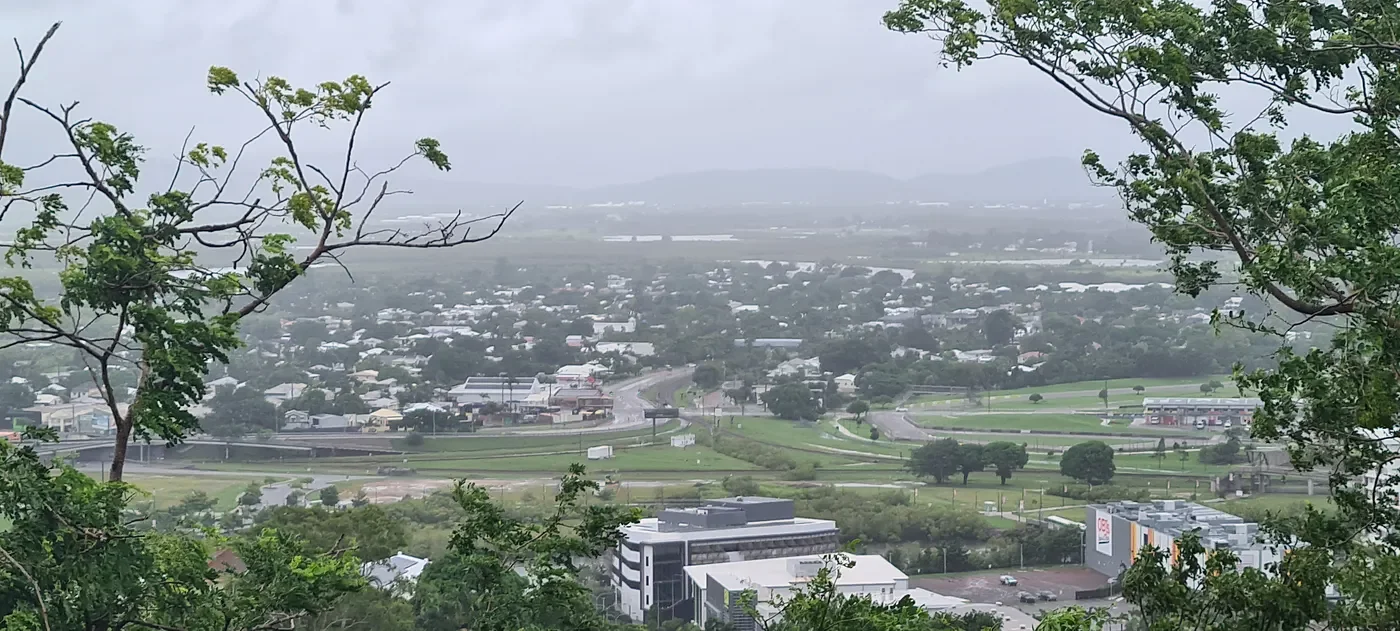
I walk onto the service road leading to the water tanks near Maidenhair Track, which could offer an alternate viewpoint, providing a glimpse of the altered landscape and the resilience of the community against the backdrop of the flooding. The view beyond the bush and trees was covered in the grey of rain and cloud. Bodies of water were between the green wetlands north of the Ross River. Some were usual, and some were not. The roads were rather empty, and large puddles could be seen in the grass. Vans and vehicles were gathered at Reid Park.
Then, the rain picked up again, and I took the cue to head back. As I did, I went to the little street library at the corner of Stanton and Victoria Streets and grabbed a read to pass the storm — The Rúin, by Dervla McTiernan.
The news continues…
The Burdekin, Ross and Haughton, all the way down to the Pioneer River and a generalised flood watch does extend in ladder place like Charters Towers and we also see flooding for the South Johnston. Also, the Mulgrave River up towards Gordonvale. So, plenty of rainfall. Plenty of warnings reminding people to stay up to date.
Now, a new story is emerging…
Let me tell you about Euramo, a charming small rural locality nestled within the heart of the Cassowary Coast, a region known for its stunning natural beauty and rich agricultural land. With a modest population of just 114 residents, Euramo offers a sense of community and tranquillity that larger towns often lack.
Bounded to the north by the flowing Tully River and to the south by the tranquil Murray River, the locality benefits from its proximity to these vital water sources. The rivers not only provide scenic beauty but also support the local ecosystem, contributing to the area’s agricultural activities and overall landscape.
The Bruce Highway, cuts through the eastern part of Euramo, providing an essential link to nearby towns and larger cities. From the south-east, it enters Euramo from the direction of Murrigal and continues its journey north-east to Silky Oak. In addition to the highway, the North Coast railway line runs just to the west of the Bruce Highway, adding to Euramo’s strategic location. The railway provides an essential transport corridor for goods and passengers, reinforcing the region’s connection to larger markets and transportation hubs. The Euramo railway station serves as a key point of access for the residents, providing a convenient travel option for those wishing to venture beyond the locality.
Despite its small size, Euramo holds a special place in the Cassowary Coast’s tapestry, where the natural environment, transportation links, and a tight-knit community blend together in harmony. Whether it’s the flowing rivers, the roads that bring people together, or the railway that runs through its veins, Euramo is a peaceful yet connected corner of the world.
During this historic flooding event, a story from Euramo would spread far and wide across North Queensland — a tale of resilience, camaraderie, and a community refusing to be beaten by the rising waters. Once again, the pop-up ‘yacht club’ emerged as a beacon of defiance, rallying the locals together in the face of adversity.
For the second time in just over a year, Hotel Euramo stood its ground against the encroaching floodwaters, refusing to close its doors when the community needed it most. As the Cassowary Coast battled yet another bout of wild weather, the iconic pub became more than just a watering hole — it became a refuge, a meeting place, and a symbol of the unwavering North Queensland spirit.
Despite the floodwaters swirling around them, the pub remained open throughout the weekend, with locals finding a way to arrive by boat, docking their vessels right at the front door. It was an extraordinary sight — boats tied up where cars would normally park, their owners wading through the water just for the comfort of a cold pint and a chat with friends.
The Euramo Yacht Club, as it had jokingly been dubbed after previous floods, had once again taken shape — not in defiance of the crisis, but as a celebration of the unbreakable community spirit that defines life in the tropics. Through the chaos, laughter echoed across the water, glasses clinked in solidarity, and the bonds of mateship only grew stronger.
In tough times, communities either pull apart or pull together. Euramo’s residents had chosen the latter — not by running from the floodwaters, but by rowing straight into them, with a beer in hand and a smile on their faces.
As residents try to unwind in the afternoon with a refreshing ale in hand, the ABC spoke to a woman named Tish from the Euramo Hotel, who couldn’t tell you how many people were in the pub at the moment. There was a fair bit of floodwater around, with a really strong current right at the front of the pub, where people usually park their cars. Today, they could not come in with their cars, and the current was really strong. But as far as Tish knew, the water hadn’t entered anyone’s homes.
She was there for the previous edition of the Euramo Yacht Club in December of 2023, just after Tropical Cyclone Jasper, when they had flooding that made headlines. There were plenty of people there at the moment. As for how many vessels were tied up to the front entry, there were 23 earlier, but not as many once things calmed down. They had a few little showers but nothing heavy, and a little bit of wind, but for the most part, the day had been relatively calm. That’s encouraging news.
It seems that the Euramo Hotel or the Euramo Yacht Club is doing well, and it’s clear that the local residents are making the most of their afternoon, gathering together with a strong sense of community. Their properties haven’t had a lot of water, so they’re enjoying the moment, sharing drinks and enjoying the close-knit spirit.
I wrote in saying, “I’m recording a log of what I see and encourage others to do so it may be useful for future record.”
Power outage or in an emergency now is the time to check your radio works has plenty of spare batteries and make sure it’s tuned to your local ABC radio station.
ABC News comes in. Flooding is expected to impact at links to 1700 homes in Townsville in North Queensland as a fresh emergency alert is issued for another suburb…
Residents of the Townsville suburb of Bluewater are being told to leave immediately and be dangerous and life-threatening flooding. The local disaster management group says homes in the six so called black zone suburbs and beginning to flood modelling suggests about 1700 properties in those areas will be impacted.
The Disaster group chairman, Andrew Robinson, said some residents have refused to leave. After being door knocked by authorities, but I think that I may be safe at home. However, they will become an island, effectively surrounded by large waters. All other towns or suburbs remain under a watch and act alert. Evacuation centres have been set up at Heatley Secondary College and the Townsville Sports Precinct. Livestock can be taken to Townsville. Showgrounds.
Chief Superintendent Graham Payne is urging locals to heed the warnings. “For those that remain, I urge you to listen to any of the warnings that come out. If you feel that you are in a dangerous situation, contact authorities if there is an opportunity to leave that should be taken.”
Severe flooding has claimed a live in Ingham, about 100 kilometres north of Townsville and SES boat carrying locals capsized this morning. Five people were rescued but a woman’s body was later discovered. A report is being prepared for the coroner.
Premier David Crisafulli says these could be Ingham’s worst flood. Reports indicated it is threatening to be as big as 1967, which is the flood that everybody uses the benchmark. It’ll be bigger than 1977, it’ll be bigger than 1998. This is a once in a century occurrence for that community and we just need to let them know that will be there in the weeks, months and years ahead.
An emergency alert remains in place for Hinchinbrook, which takes in Ingham. A separate warning is current for Cardwell. Authorities say dangerous and life-threatening flooding is occuring in those areas and residents should take shelter. The Weather Bureau has issued a severe thunderstorm warning for areas between Townsville and. It says storms are likely to produce heavy falls leading to dangerous and life-threatening flash flooding over the next several hours.
A senior forecaster says the conditions aren’t ideal and was most concerned about those on and adjacent to the coastal areas and into the Ranges, particularly between the Ingham and Townsville area where we continuing to see torrential rainfall dropping anywhere from 50 to 80 millimetres an hour for multiple hours, power has been cut to more than 8000 properties across the states north and far north. About 6000 of those homes are in Ingham and around 2000 in Townsville. The community of Palm Island is also without power after a landslide.
Ergon Energy says residents need to be prepared for prolonged outages.
Federal disaster assistance payments are available for some impacted residents in Townsville and Gordonvale in the Far North. Senator Jenny McAllister says residents can register now. There is $180 emergency payment available and up to the $900.00 for a family of five or more. There are other forms of financial aid that include cover for damaged household goods and income tested grants for structural repairs in the RE connection of services.
As for Queensland weather, a severe weather warning is current. Heavy, locally intense rain and damaging winds over NE Queensland. Heavy rainfall which may lay to flash flooding, is forecast between Tully, Ayr and land to the far eastern, northern Goldfields and Upper Flinders. Isolated to scattered showers and storms across most of the state tomorrow, apart from the southern interior and far southwest.
Plan from the worst, hope for the best…
Is a 100-year flood map even worth the paper it’s written on?
The Burdekin Bridge is now closed, and Townsville is completely cut off. Giru remains in immediate danger. Authorities are urging residents to follow their evacuation plans and seek shelter with family or friends in designated safe zones.
An emergency warning remains in place for six Townsville suburbs under evacuation orders. The Queensland Police Service (QPS) and the Australian Defence Force (ADF) are continuing to evacuate homes, including those in Hermit Park, Idalia, Annandale, Railway Estate, and Rosslea. These six suburbs form Townsville’s so-called Black Zone, where authorities warn flooding is inevitable. Residents were instructed to evacuate by noon today.
Townsville Airport has closed, and the Townsville University Hospital has cancelled all elective surgeries scheduled for tomorrow.
According to Townsville Disaster Management Group coordinators, homes in the Black Zone are already flooding. “At the moment, due to the current water levels, we estimate that around 80 properties are affected,” they stated. Model projections suggest that this number could rise to 700–800 properties by the time the event is over.
The Heatley Evacuation Centre has reached full capacity. Residents are now being directed to the Townsville Sports Precinct, and an additional evacuation centre will open at Ignatius Park College tonight.
Evacuees had little time to prepare, grabbing only small bags of clothes and irreplaceable treasures like family photos. However, many remain hopeful, saying, “You can always start again.”
Police are preparing a report for the coroner after a flood-related death in Ingham, about 100 kilometers north of Townsville. An SES boat capsized during a rescue operation this morning — while five people were brought to safety, a woman’s body was later recovered.
There have been 40 flood rescues across North Queensland today as floodwaters continue to rise. More than 8,000 properties are without power across North and Far North Queensland. 6,000 homes are affected in the Hinchinbrook region. Around 2,000 homes in Townsville are also without electricity. Palm Island has lost power following a landslide.
Ergon Energy has switched off the Ingham substation for public safety. Authorities are also urging residents evacuating their homes to turn off all cooking appliances before leaving. Federal Treasurer Jim Chalmers has pledged that the Federal Government will provide whatever support is required as the emergency unfolds. He confirmed that assistance is already being rolled out and warned that it will be an anxious few days — first as rivers continue to rise, and then as the clean-up begins. Prime Minister Anthony Albanese and his government are monitoring the situation and have assured Queenslanders that they will be there to help those affected.
A severe thunderstorm warning is in effect for the Herbert and Lower Burdekin districts. These storms could be very dangerous, bringing intense rainfall that could lead to life-threatening flash flooding over the next several hours. Paluma has already received more than 700 millimeters of rain in the past 24 hours. A severe weather warning is also in place for the North Tropical Coast, with heavy rainfall and flash flooding expected between Cowley Beach and Giru, extending inland to the Far Eastern Northern Goldfields and Upper Flinders.
It has become a catastrophic event as evening falls. We did have a respite this afternoon, but the Bureau predicted it is picking up again into the evening, with 24 hour totals possible in an area really from Cardwell to Yabulu of up to 500 millimetres over the next 24 hours and in the wider area from Tully to the Burdekin may see rainfall up to 300 millimetres in the next 24 hours.
There is significant concern for the Ross River catchment at the moment. Currently Ross River Dam is at 160 plus percent. The last one the radio saw was 164, but it’s undoubtedly increased more than that. And the concern with the water getting too much higher is that it might facilitate the need for the dam gates to be fully opened. Flooding of the Ross River is apparent at Aplins Weir. It is expected that the major flood level will be here at 1.8 metres and then it could exceed 2 metres, which brings into a play at potentially massive flood of the lower lying suburbs of Townsville. We still don’t know whether that will indeed materialised, but it is very much a cause for concern.
We cannot call these freak events. Climate change is playing a role here. For every degree of warming, the atmosphere increases in moisture by 7%. If there’s more moisture in the atmosphere right from the word “go,” then there’s more rain to be had. There’s just no question about that. In the science community, there is no debate. We know that the probability of an extreme event occurring is increasing every single year. So going back to that one in 100-year event type scenario, remembering that it is just a statistic — and that’s the one that the insurance industry uses by the way, so we’re kind of stuck with it. The problem, the chances of you experiencing a 100-year event is increasing every year. So, in 10 years, 20 years, 30 years, we’re going to see more and more of these things and they’re going to get bigger and bigger. So, the hundred-year event is getting bigger all the time, so. This is the future. We’re living it now. We’re living in climate change. This is what the future holds. Not every year, but we’re going to see this more and more. This is the reality. We survive this event 1st, and then we begin to wonder what we need to do to better prepare our communities for the next one.
Paluma has ticked over 400 millimetres.
Infection and serious illness or even death. So, what’s in flood water? Dirt, mud, branches, rocks, chemicals, bacteria, faeces, snakes, spiders, dead animals and much, much more. Assume all flood water is contaminated. Avoid contact. And protect yourself.
Driving into flood water is the main cause of death in floods. Many of these drivers were in four-wheel drives and youths flood water over the road and looks still that can hide fast flowing water underneath. It can be hard to estimate how deep the water is or how strong the current can be. If you come across water over the road, turn around. Stay safe by never driving through flood water.
As darkness falls, I decide to take a break from listening to the radio, having heard enough important and useful information to last until Monday. The breaks in the rain are gone now, and it falls once more. Grey clouds swirl in the heavens. A heavy sense of loneliness comes across. This is the first time I’ve been alone in the house while something like this is happening. Nobody is here to be with me through it. No-one for mutual support.
My home city is under threat, and there isn’t much I can do to prevent it. I don’t like being unable to do anything or help anyone.
I hope I can share this story, or any story, with the wider community. I still haven’t published my book of the previous major floods like I hoped I would last year. Would many people read it anyway? Will my vision really be shared? Questions like these keep tugging at my mind even during something like this. I always tended to be restless anyhow.
I need some distractions from these thoughts…
Said distractions involved cooking noodles, listening to the Gathered Friends podcast, and writing a new short story. A text now reads that for the evacuated suburbs, it is “NOT SAFE TO RETURN. A dangerous flood is still happening. Do not return until it is safe.”
3/02/2023
I picked Dad up from the airport.
Floodwaters are rising for 3rd day across parts of North Queensland. There were 11 rescues overnight with the SES fielding almost 500 calls for assistance in the past 24 hours
Severe weather warnings remain current for parts of the North Tropical Coast, the Tablelands and the Herbert and Lower Burdekin. Six hourly rainfall totals of up to 140 millimetres a likely reaching 180 in some places. Townsville residents are being warned that floodwaters are expected to peak in the city tomorrow morning, with 1700 homes in the so-called Black Zone at risk. The Queensland Premier says the ADF has been approached for aerial support. The Defence Forces on standby and they have agreed overnight to the use of some of their assets if required.
Emergency alerts are also currents for two regions on the Cassowary Coast. The QLD disaster coordinator says communities in the north should stay up to date with the latest emergency information. They did see multiple emergency alerts going out, flash flooding in the areas of Cardwell and Bluewater yesterday afternoon and into the evening. They saw 480 requests for assistance for SES in the past 24 hours align and the chief officer of the SES. It’s been their busiest night so far during the response.
The Weather Bureau says there’s likely to be a gradual weakening of the low-pressure system at the centre of the flooding disaster. That rainfall is expected to ease over the next 24 hours and as you move into Tuesday, Wednesday, that easing trend continues. But there is a lot of water in those catchments is already an incredible mass of water on the ground. There is more significant rain to come, so it will take days for that water to come out of those systems. Dozens of schools in North Queensland have been closed due to the bad weather. The Education Minister says there’s information on the department’s website.
Efforts are underway to fix widespread Internet and phone outages. Amid the weather in the states, reports say thousands are without Internet, fixed line and mobile phone services and thirty key network sites have lost power. The outages are affecting customers in flood affected areas between Cardwell in Townsville as well as north of Cairns in Mossman. A disaster assistance package including more mobile phone data has been issued for customers in the Cassowary Coast, Palm Island, Hinchinbrook, Townsville and Burdekin. Telstra says technicians with portable generators are being deployed, as some communities are unable to make triple-zero phone calls at this time.
Today possible heavy rain about the tropical east coast to Cape Tribulation. With intense falls that could cause flash flooding between Tully and Ayr. Brisbane mostly fine today with the top of 30 degrees. Showers and storms continuing tomorrow for northern districts.
The Country Hour told of the catchments, lost bridges damaged roads and no communications. Northern Queensland is working through six months’ worth of rain in just three days. Out West, it’s still an anxious wait to see if there’s even a beneficial drop of rain. Properties are reporting walls of water, and waiting for to recede, so they can assess the full extent of the damage.
Back at home, the “On This Day” feature of my OneDrive app has shown that all of this is happening around the same date at the 2019 Townsville Floods after all. There’s a selfie of me with my blue umbrella I’ve had since Korea next to the two waterfalls. Two massive streams of water, reminiscent of gracelessly folded white curtains, descended down the stone wall. Even before reaching the base, these streams merged and united into an even more formidable torrent. I could observe the very end of the waterfall, where it flowed through the spaces between properties.
My father went over to the Apple Lodge, a quaint property nestled on McIlwraith Street now closed down. Over the years, we had borne the weight of numerous responsibilities to keep the place in order. However, the recent deluge had presented us with a challenge not seen since the floods.
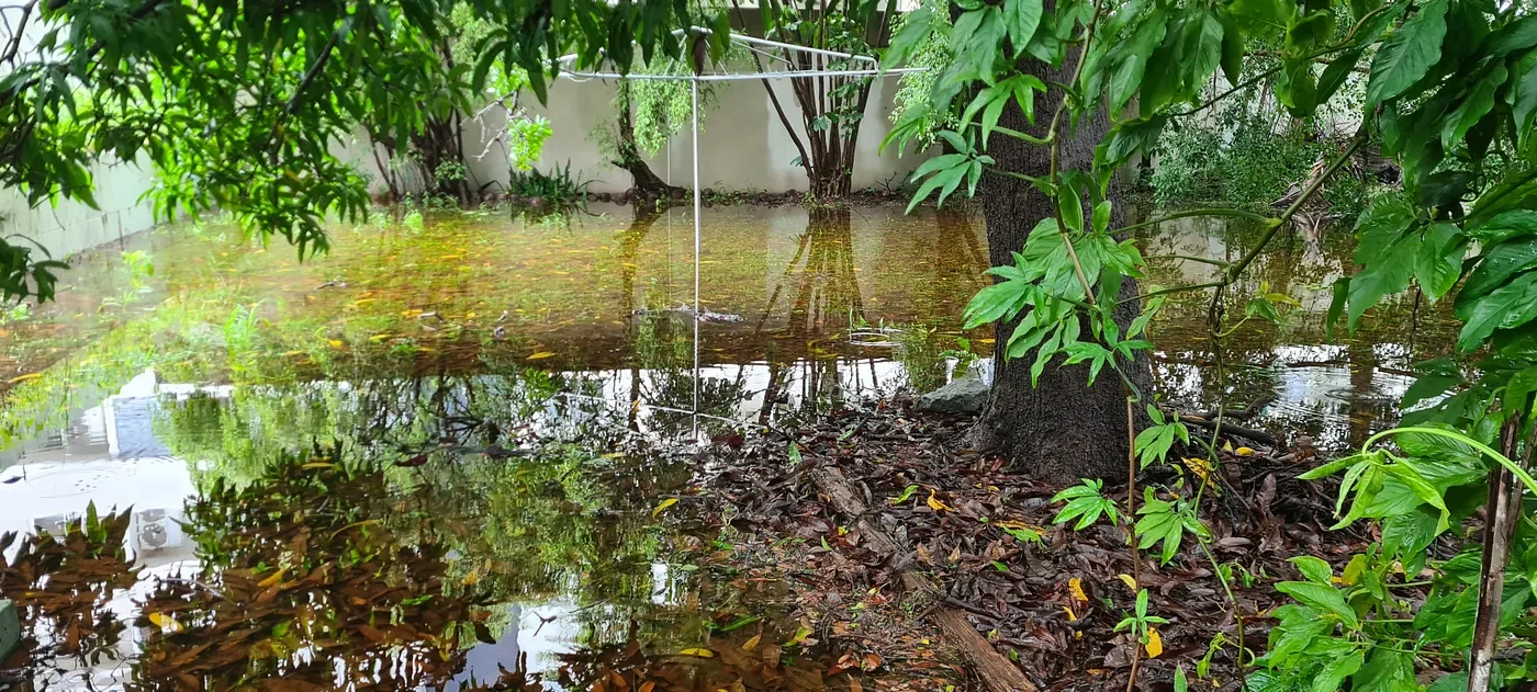
Dad and I took a subtle way in, taking care to not be seen by the nearby cottage tenants, lest they give Dad an earful he didn’t want. We made our way across the side, careful of contaminants in the water we had to step through. The entire surrounding yard had become a green swamp, with clear water immersing the backyard from end to end. The elevated concrete porch was an island.
The large tree that had been a central feature of the backyard was now marooned in the midst of this newfound marshland. The whole situation was a stark reminder of the consequences of decisions made by builders of neighbouring developments. They had blocked crucial waterways, likely believing them to be superfluous.
The only way to drain it out? A small drainage at the side. We dug a canal out of the leaves and debris to allow the water to flow to it. Progress may be slow, but Dad says that once the storm passes, he’ll go to the Townsville Yacht Club and borrow a siphoning device and a pair of large rubber hoses to drain the water out the driveway. It was the same resourceful scheme we used in 2019.
By nightfall, after catching up on War Thunder, I see the rain has gone, seemingly for a while this time. The only sounds are the stirring of still flowing waters and choruses of lively frogs. It seems we have finally reached the worst of it. All that’s left is for the water to withdraw and flow out, but that will still take a while.
Then, I went for a walk around the suburb. I was not interrupted by rain for the whole duration. Yet still, water remained flowing from curbs and drainage. Along the way, I saw Castle Hill illuminated in blue from the lights. It looked darker than usual, as a result of damp water across all of the rock. Going further, I passed the Townsville Sport Precinct, which had been turned into a shelter late into the floods after usual spots like Heatley began to fill. Some evidence still remains in the form of more lights and parked cars, but that’s about it.
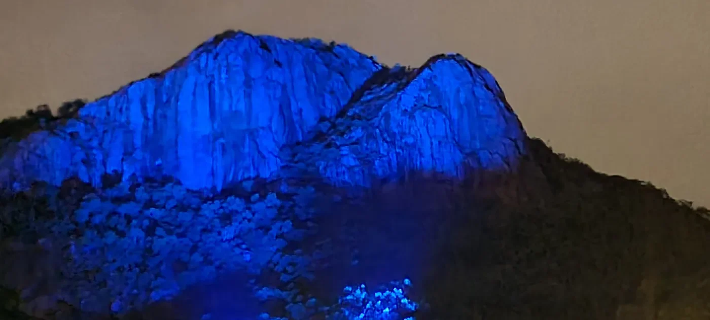
Castle Hill after the rain
Later in the night, I lie on the couch, finally getting round to watching Venom: The Last Dance. The rain is back…
4/02/25
The next day, the sky is silent, but I don’t trust it yet.
My cousins Daryl and Sarah had arrived to bring back their car from high ground. They told of how their door was knocked on four times recommending them to leave. However, they live in an elevated Queenslander house with a generator and lessons learned from the 2019 floods. With everything in the lower level moved up and the car taken to our high ground, they were set. Nonetheless, the doorknockers apparently became firmer, telling them they were ignoring warnings. One of them apparently told them a lot of effort was made to send them up from the Sunshine Coast for this.
Nonetheless, the house was not flooded. The Ross River did not break its banks in their area like it did in 2019. So instead, it was a lively chat with us and then back to normal.
There was one thing I saw while watching stuff late at night. During today’s parliament question time, Senator… Ross, I think, was briefing about these North Queensland floods, praising the responders, rescue services and ADF for their service, and other rather positive stuff. I didn’t stick around for much more and instead watched Father Ted on BritBox. Much more interesting.
6/02/2025
After giving my car bumper a fix, I thought I’d go back to Menulog delivery driving again. North Shore, where the bonuses are, was not hit so hard, so it was mostly business as usual.
However, there were still some raw potholes in Bushland Beach and Burdell, and they are really nasty to hit. They appear in your headlights for just a second, usually quicker than you can dodge it, then wham! So much of the 5pm-to-9pm shift involving keeping an extra close eye on the road. Two people ordered from the kebab shop at the Lakes, and those long-distance ones paid really good.
7/02/2025
Today was more of the usual stuff.
In the evening, I went for a shift again, listening to Hammerfall on my Bluetooth. The Bohle Wetlands are still filled up with water. The sandbags blocking the body of water just before the Bohle River have brought the waterline to above the road, much to my alarm. The river itself was really high, coming just short of the lower bridge. The Saunders Creek in Deeragun was overflowing, cutting off the sidewalk.
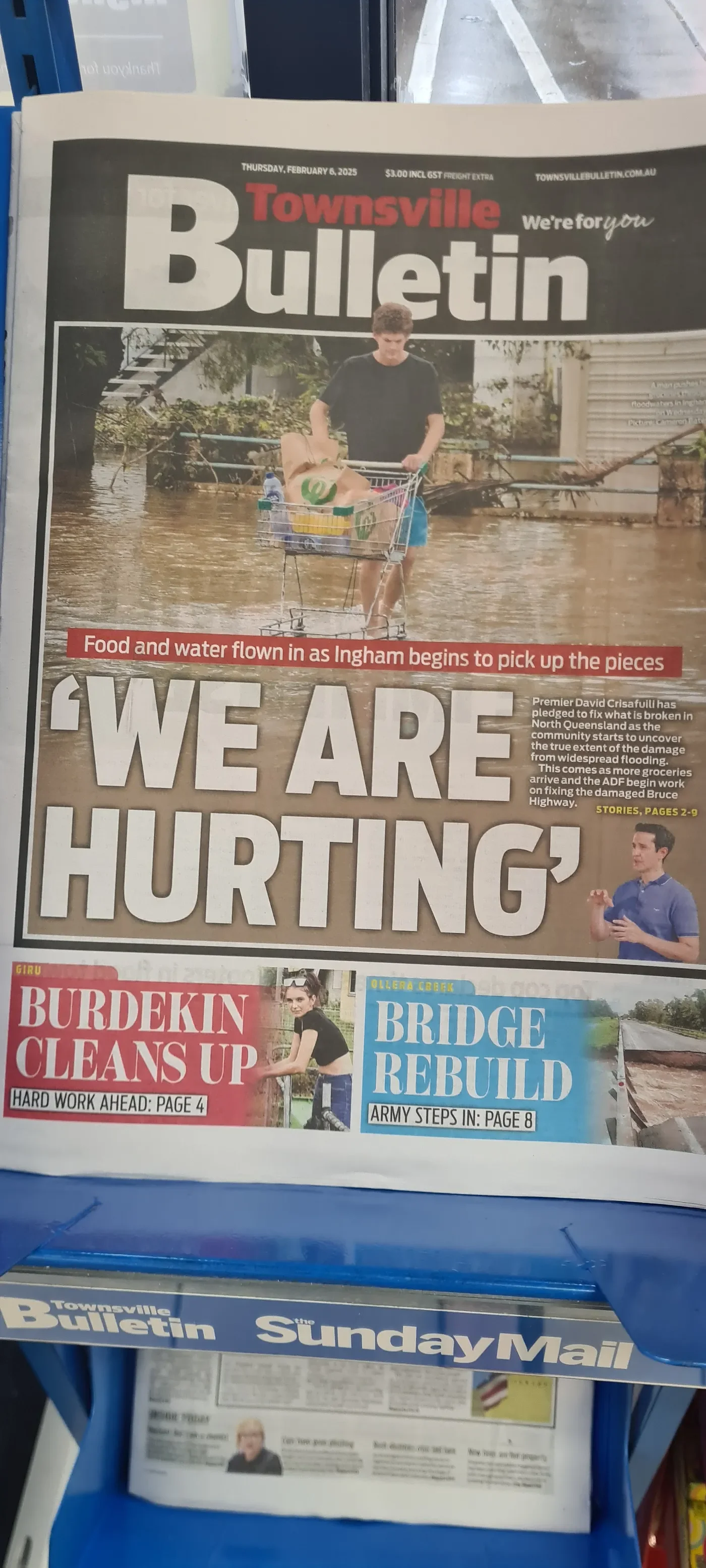
Going into the Night Owl to grab some caffeine, I heard the news about the floods. The emergency is still in effect. I saw the front page of the Townsville Bulletin, and decided today was a day to take it seriously. Today’s headline was about how the “food and water flown in as Ingham begins to pick up the pieces.” Premier David Crisafulli, it said, has pledged to fix what is broken in North Queensland as the community starts to uncover the true extent of the damage from widespread flooding. This comes as more groceries arrived as the ADF begin work on fixing the damaged Bruce Highway.
The Bruce Highway under work? At least there’s still some normalcy there.
I didn’t read beyond that, but another headline for the pages inside showed about how “Burdekin Cleans Up” and “hard work ahead” for around the Giru River. For the Ollera Creek (which is in Moongobulla, just south of Mutarnee), there’s a “Bridge Rebuilt” as the “Army Steps In.”
Meanwhile, down below, the Australian seems far more interested in the US President and Israeli Prime Minister meeting for a proposed “clean-up” of their own. Helpful, Murdoch… Real helpful…
That was a busy night, but I come home to the first few episodes of Season 3 of Invincible on Prime Video. About time!
8/02/25
There’s blue in the sky again.
9/02/25
Around noon, my Dad and I go and see my Uncle Peter in Townsville University Hospital. To get there, we went through the suburbs of Oonoonba, where the water still lurked in the sides of the road. Dad commented that Lakeside Drive’s name had a bit of irony to it now.
Then, we drove along the road into Fairfield Waters, where Lake Idalia had risen to unusual highs, even consuming the footpath. The other bodies of water also loomed above their usual height.
We drove into Cluden, where I knew the raceway would soon become the new place for the Stable, once at the Strand and Riverway. When it does, I will surely remember this moment.
Driving along Lavarack Barracks, we observed how the Army inside had mobilized to assist, especially with the bridge up north. The ADF plays an invaluable role in assisting with disasters like these, which is why they must continue to do so.
Reaching the hospital, things seemed normal. Uncle Peter is in a worse state then he was in palliative care, but otherwise in decently high spirit.
And again, the rain comes later in the evening! But wait… by midnight, it stops. It stays silent for a while. Could it really be?
10/02/2025
I heard more news…
The Bulletin’s front page showed “NQ Grit.” Inside ground zero, Ingham’s spirit is rising above floods and heartbreak. The front image showed two blokes making the most of a bad situation and have a game of pool in the flood waters in Ingham as flood water remains devastatingly high.
Meanwhile, floods wipe out roads, cutting off Paluma. Paluma businesses were crying out for help after record floods wiped out roads, destroyed vital equipment, as the floods had left them completely cut off from supplies and communication. Hidden Valley Cabins had been forced to cancel all their bookings, facing losses in the tens of thousands as they fought to rebuild.
A temporary bridge was on the way. Prior to this, Ollera Creek was simply another creek along the highway, but now the Premier himself has visited it, saying a temporary bridge should be up and running by next week for a much-needed connection between Townsville and the frontlines of Ingham.
As the threat of the Burdekin River eased, focus was on supplies, as the Bruce Highway opened to trucks only.
Small business owners in Paluma were pleading for help from the government after record flood waters destroyed roads and equipment after record flood waters destroyed roads and equipment, cutting them from supplies and communication.
The recovery at Hinchinbrook, remained slow. There was an image of pallets being unloaded by for a Republic of Singapore Air Force CH-47F Chinook helicopter outside Ingham State High School on Sunday. This really is an interesting time. Although, RSAF choppers in this region are not as uncommon as one might think, as they exercise and train here regularly
12/02/2025
Out and about in the morning, I went and acquired two litres of sterilizer to combat mould for the house.
At night, I decided to watch Doctor Who again. First episode that popped up was Asylum of the Daleks. The one where a new character named Oswin Oswald keeps a log while being stuck in a room, that’s later revealed to be the mind of a Dalek she’s been converted into. Boy, do I know the feeling right now, keeping such a log. Only difference this whole debacle is not trapped in a Dalek’s mind — although you would think that.
13/02/2025
It’s a calm, beautiful morning. The sky is a radiant blue once more with scattered clouds in the distance. The bush is green amongst the rock and gravel. The breeze is gentle against palm fronds, which is quite a reprieve from the wild winds that rocked the entire trees. Aside from that, the air is still and serene. The whole land is relieved of the storm’s fury now that it has passed.
Gentle Celtic folk music suits the moment while writing. During this particular moment, it was the light notes of Orla Fallon’s harp to the tune of Siúil A Rúin, which I listened in its various forms during the blackout of Kirrily.
The very ocean itself was a noticeably darker shade of blue, like the sky at high altitude or the high seas. A brown ribbon of sand showed that the rivers were flowing steadily out to sea.
It’s over… Is it really over…?
14/02/2025
I was just in the middle of editing my blog, getting it ready for release, and then…
Black thunderclouds roll over Castle Hill, heralded by thunderous booms. An ecliptic shadow sweeps over North Ward and out to sea. I watched the sunny day just get deleted. The rain comes in force again. Yes, again!
By this point, I know the blog will be uploaded a bit late. The iron may not be hot anymore, but I have to upload it. Even if it doesn’t get as many views or likes, I cannot give up.
24/02/2025
Oh, you thought it was over? Yeah, as it turns the wet season is not done yet. We’re all over it, but it’s not over us. Oh, no…
The rain returns this afternoon. It’s quite violent. The drops are heavy, practically lashing the roof in a continuous wave. Ironically enough, the rain caught me reading Godzilla content online.
Tropical Cyclone Alfred has formed about 910 kilometres north-east of Cairns off the Queensland coast. The system is predicted to move further offshore before potentially turning towards the coast. According to the US Navy weather radar, it is travelling at 60 knots. In other words, it is steaming fast. Heading south in a real hurry.
Alfred, eh…? I can think of a few references that name brings up, from Bruce Wayne’s butler to the character in The Prestige. But really, my first honest thoughts were that of Alfred from Johnson and Friends. Yes, that Australian children’s television program that originally aired on ABC from 1990 to 1997 was not a fever dream. I personally wasn’t born in time for it, but anyone who watched that ABC For Kids trailer at the start of VHS tapes back in the day would remember these lines of dialogue around forty seconds in…
“We have to trick Alfred…” says Johnson, the pink elephant.
“Are you talking about me?!” Alfred himself say, flapping around.
“No, Alfred!” says McDuff, a blue and yellow concertina.
Watching it now, the show is really quite bizarre. But still a good enough concept to go for seventy-eight episodes across four seasons.
Now, uh… What was I talking about? Oh, yes… The rest of the day carries on fine.
As I read more about Alfred, a brief sound of thunder rumbles in the distance. Even in life, there’s ominous sounds of foreshadowing.
As it stands, Tropical Cyclone Alfred has formed off the Queensland coast, with the Bureau of Meteorology closely monitoring its development. The system was officially declared a category one cyclone in the Coral Sea late Sunday afternoon.
Currently positioned 910 kilometres northeast of Cairns, Alfred is expected to intensify, moving southeast before gradually turning south in what meteorologists describe as a “slow turn.” By the weekend, it could potentially shift back toward Queensland.
Forecasts indicate that Cyclone Alfred may reach Category Three strength by Tuesday afternoon, though its precise trajectory remains uncertain. In the immediate future, the system is projected to continue eastward, moving further away from the Queensland coast. However, as the week progresses, its path becomes less predictable.
Some models suggest Alfred could take a south-southwesterly track, while others indicate a southeasterly movement, pushing it farther from Queensland. Meteorologists caution that multiple scenarios remain possible, making it difficult to determine the cyclone’s ultimate course with certainty.
6/03/2025
I came back from Brisbane yesterday, and I had a fantastic time. The first night was something special — Within Temptation performing at the Princess Theatre as a side gig while they’re on tour with Knotfest across the country. It was an unforgettable experience. The music was everything you’d expect from them: epic, haunting, melodic, yet fast-paced in so many moments that kept you on the edge of your seat. What truly stood out was Sharon den Adel’s voice. Despite battling a cold, she effortlessly hit every note with such power and precision. She even admitted to the crowd that she wasn’t feeling her best, but that didn’t stop her from giving it her all. The crowd responded with overwhelming applause and cheers, respecting her dedication.
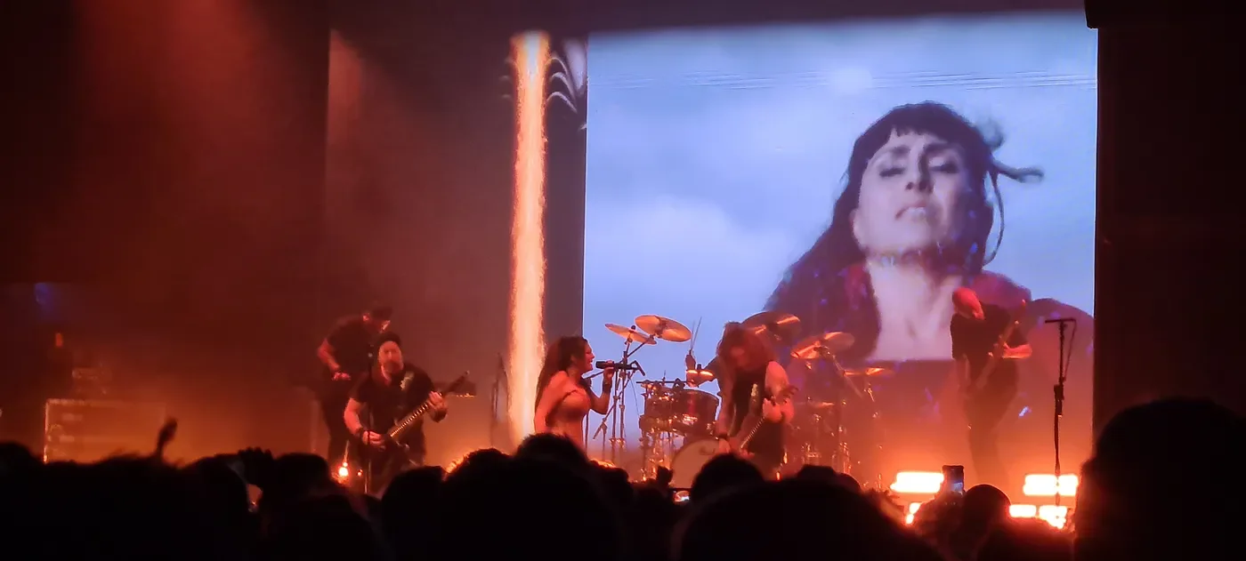
Within Temptation at the Princess Theatre (A moment I’ll never forget)
What made the night even more memorable was Sharon’s personal connection to the country. She shared a heartfelt story about how she’d watched Olivia Newton-John perform in Indonesia when she was a little girl, and it was a dream come true for her to now tour the land of her role model. The way she spoke about Olivia, it was clear how much of an influence she had on Sharon’s life, and it resonated deeply with all of us in the crowd. It’s moments like these that really make you appreciate how music can transcend time and geography.
As for the setlist, it was packed with fan favorites that had the entire theatre singing along. Highlights for me included “Faster,” which was full of adrenaline and raw energy, and “Supernova,” with its driving pace and powerful vocals. And of course, “Paradise (What About Us?)” brought the house down. With Tarja singing in the background of the projection, the song’s intensity and emotional depth were even more moving live.
Meanwhile, Cyclone Alfred was still swirling out at sea, a reminder of the unpredictable forces of nature. As we all enjoyed the music, there was an underlying sense of uncertainty about where the storm might head. It was still too early to tell where exactly it would land, and everyone kept one eye on the weather reports as we continued to enjoy the show. But for that night, the storm felt a bit further away, as the power of the music and Sharon’s voice made everything feel just a little more hopeful.
The next day, I was back at it, this time at Alestorm’s concert at the Tivoli. At this point, Cyclone Alfred had turned directly towards Brisbane, and I was worried it might hit before the concert. It was an absolutely epic night, full of high-energy music and hilarious banter. Patty Gurdy and Captain Yarrface also joined the stage, adding to the atmosphere with their unique styles and charm. But as for Alestorm, they were everything you’d expect — rowdy, funny, and full of pirate-themed chaos.

One moment that stood out, especially in the context of the cyclone, was when Chris, the lead singer, grabbed the mic with a wicked grin and said, “Alright, boys and girls… So, Brisbane! It’s a Tuesday night. First night of the weekend, right? Who’s getting f***ing drunk tonight, my friends? Who’s going to see out this cyclone with a beer in their f***ing hand?” The crowd went wild, and Chris continued, “That’s what I like to see, boys and girls. This one… goes out to all the alcoholics in the house tonight!” And just like that, the band launched into “Hangover,” the room filled with raucous energy as the crowd sang along to every word. It was one of those moments where everything felt connected, as if we were all part of the same crazy adventure, battling through a cyclone with a drink in hand.
The vibe was wild and carefree, despite the impending weather. Everyone was united in their love of music and in the sheer determination to have a great time, no matter what the cyclone had in store. It was one of those unforgettable nights where the music and the crowd created something bigger than just a concert. Alestorm, as always, delivered the kind of show that made you forget the world outside and just live in the moment.
The next evening, I made my way to the airport, aware that the cyclone was inching closer to the Gold Coast and would soon be bearing down on Brisbane. My host Kerryn had been preparing her house, as Brisbane, it seemed, wasn’t quite equipped for something of this magnitude. The city’s infrastructure was often tested in heavy storms, but something of this scale had everyone on edge.
As I walked through the airport, I expected chaos — crowds of frustrated travellers and long lines — but to my surprise, it was relatively calm. It felt almost normal, as though the cyclone wasn’t even happening. Then, over the PA system, the announcement came through that a flight to Mackay had been cancelled. I wondered, briefly, if my flight to Townsville would be next.
Well… it was the only slightly better alternative of a long wait of boarding. As we got on, a black cloud rolls over, and the rain comes. Amazingly, we still managed to take off without much turbulence. The moon passing over showed we were in the clear.
By the time we landed in Townsville, I was utterly spent. The turbulence, the waiting, the uncertainty — it all caught up to me. My mind was still reeling from the rush away from the cyclone, and my body felt like it had been put through the ringer. As I walked off the plane, I spotted my father waiting for me at the gate. He had some news once I was caught up… Peter, my Uncle Peter. The musically talented social man who always seemed to know how to make the most of any room he entered, how to make people laugh, and how to lift spirits, was finally gone. He’d struggled for years with depression, and slipped deeper and deeper into neglect, unable or unwilling to take care of himself. We’d known it was coming. The signs had been there but knowing it intellectually and hearing it out loud are two different things.
I was still in shock. I didn’t know how to feel. I didn’t feel like eating, even though I know I should. I didn’t feel like going out of my room. It is like I am stuck in a space, unable to find my footing.
As I tried to process the news, the music he had always listened to, the same songs that used to bring such joy and energy to the room, became bittersweet. I’d always been drawn to the rhythm and melody he loved so much, but now, every note seemed tainted with the sorrow of his absence. The music didn’t feel the same anymore; it felt heavy, burdened by the weight of everything he had gone through.
The log will continue as the cyclone Alfred continues to gather strength, but there’s already a heavy price to pay. A price that I didn’t see coming, that no amount of preparation could have steeled me for. Despite the storm raging outside, this was the storm inside me. I had no idea how long it would last, but for now, it felt like everything had changed, even if nothing else had.
In times like these, I turn to the soothing sounds of soft Celtic folk music. There’s something about the simplicity of it that brings comfort, like a gentle hand on your shoulder. “Siúil A Rúin” in its many beautiful variants always seems to hit a chord. The haunting melody, the steady rhythm, it’s like the music knows exactly how to speak to the emotions you can’t quite put into words. Artists like Celtic Woman and Orla Fallon have become a steady source of solace, their voices echoing the same kind of warmth and tenderness I need in those quiet moments of reflection.
But sometimes, I find that certain songs cut deeper. Back in the Within Temptation gig, Sharon pointed out to the crowd in Brisbane that “Supernova” was a song she wrote for her late father, a song for those missing someone. The words, the melody — they resonate in a way that feels both personal and universal. It’s a song for grief, for remembering those we’ve lost, and for the longing that stays with us, even when we think we’ve come to terms with it.
7/03/2025
I don’t know what I’m doing. The uncertainty gnaws at me, a slow-burning frustration that I can’t shake. I’m bitter, mad at the world, confused about where I stand in my writing career. One moment, I feel like I’m making progress, like all the effort and years of work mean something. The next, it all feels like I’m grasping at smoke — chasing a dream that keeps slipping through my fingers.
Maybe it’s just exhaustion. Maybe its grief making everything feel heavier. Or maybe it’s the quiet fear that no matter how much I write, how many words I put out into the world, it will never be enough. I just don’t know.
I can’t do this anymore…
The next night, I stir in a sleepless haze, thoughts circling endlessly like a storm trapped in my skull. No matter how I shift, no matter how I try to clear my mind, the weight of uncertainty presses down. About my writing. About the future. About everything.
The room is dark, but my thoughts are loud. I glance at the clock — hours have passed, but sleep refuses to come. Maybe it’s grief. Maybe it’s doubt. Maybe it’s both, feeding off each other in the quiet hours of the night.
8/03/2025
Alfred has begun to lose power, likely due to the colder water.
During delivery runs, I saw the front page of the Courier Mail. The headline read “ALF’S ARMY” and told over how QLD heroes were ready to help as Alfred unleashes fury across southeast — with a picture of a lifeguard man, a lady in doctor gear and an SES man. They’re the heroes who embody that quintessential Queensland spirit. They’re in our neighbourhoods, on our beaches and in boats. Some are in uniform, others just want to help in whatever way they can, often putting their lives at risk to save others. And as Cyclone Alfred tears through Southeast Queensland today, they’ll be at the ready to help their fellow Queenslanders and keep us safe.

9/03/2025
The Queensland Police Service has advised all southeast Queensland residents at all emergency alerts issued in the last 48 hours that are relevant to Tropical Cyclone Alfred have been cancelled.
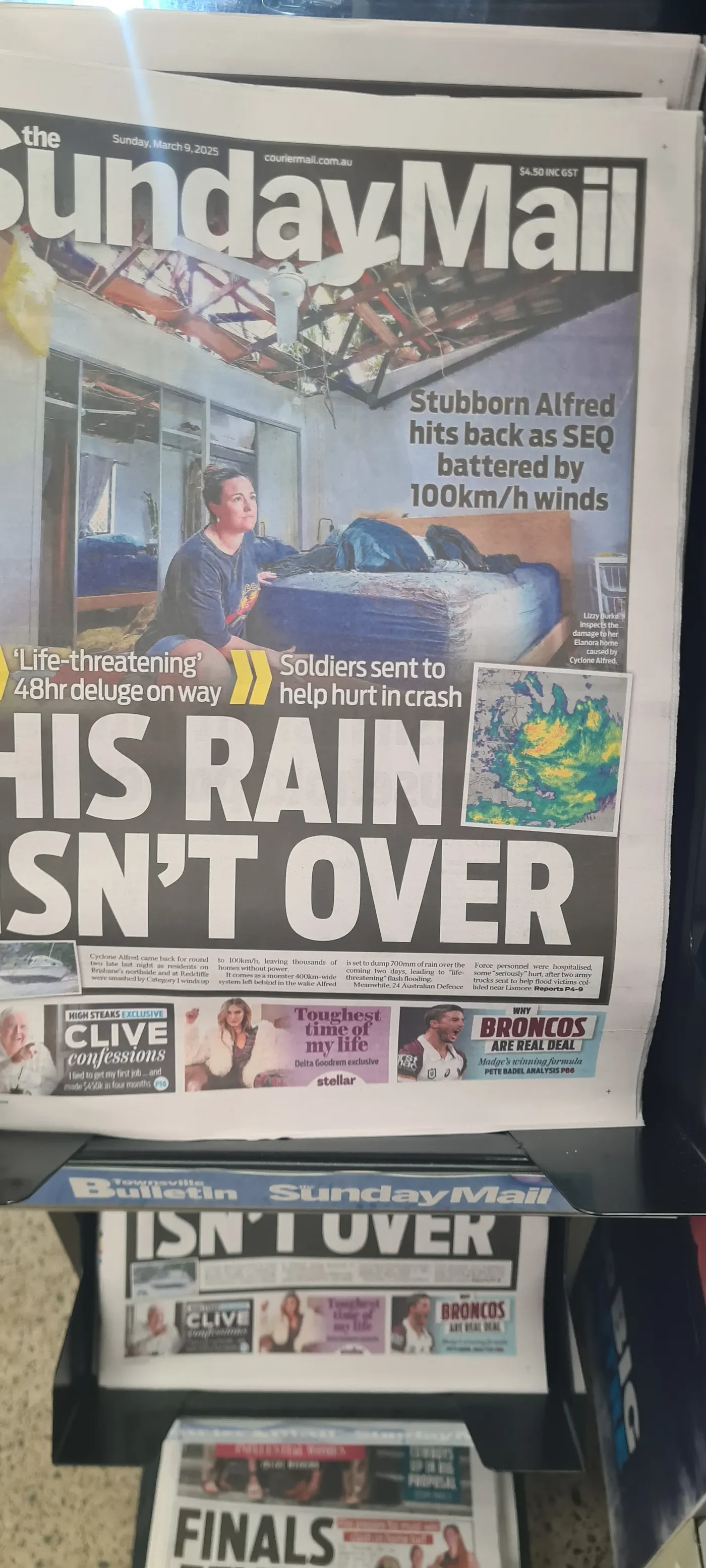
However, the Sunday Mail carried the headline “His Rain Isn’t Over.” It talked about a life threatening 48-hour deluge on the way as soldiers sent to help were hurt in a crash. Cyclone Alfred came back for round two late last night as residents on Brisbane’s northside an at Redcliffe were smashed by Category 1 winds up to 100 kilometres per hour, leaving thousands of homes without power. It comes as a monster 400-kilometre-wide system left behind in the wake of Alfred is set to dump 700 millimetres of rain over the coming two days, leading to life threatening flash flooding. Meanwhile, twenty-four Australian Defence Force personnel were hospitalised, some seriously hurt, after two army trucks sent to help flood victims collided near Lismore.
17/03/2025
It’s St. Patrick’s Day, a lovely day for me. However, the weather seemed to honour Ireland by being rainy a lot. There went my plans for the night on the town.
Instead, the rain lashes the roof again, and I worry we may have two floods this year after all.
8/04/2025
Finally, it’s over…
The wet season of 2025 was long and restless, unfolding in waves and tempests like waking from one dream into another during a long night, each more vivid and unpredictable than the last. Here’s the overall summary…
Northeastern Queensland experienced major flooding across three key periods in late January, early February, and mid-March 2025. The disaster led to at least two confirmed fatalities due to floodwaters and 16 additional deaths linked to a disease outbreak. Mass evacuations were ordered across coastal communities, and the floods are estimated to have caused $1.2 billion AUD in damage to Queensland’s economy.
The Shire of Hinchinbrook — home to around 11,000 residents and located approximately 1,500 kilometres north of Brisbane — was among the hardest-hit areas. Severe flooding also affected suburbs in the nearby city of Townsville, with Giru particularly impacted. Townsville University Hospital announced the cancellation of most elective surgeries scheduled for 3 January, continuing only urgent procedures.
By 3:30 PM, the Ross River Dam reached 163.8% of its capacity, prompting local disaster authorities to close the area to the public and restrict access. Floodwaters also caused the collapse of the Bruce Highway’s Ollera Creek Bridge north of Townsville. This cut off vital road access and delayed supplies to northern communities. In response, the federal government deployed the Australian Defence Force to work with Queensland’s Department of Transport and Main Roads to construct a temporary fix for emergency access. Both the Prime Minister and Queensland Premier committed to rebuilding the bridge to a higher standard to withstand future disasters.
In Cardwell, flooding submerged residential zones, especially along Roma Street. The Cassowary Coast Regional Council issued emergency warnings for the town, alerting residents of rising water in low-lying areas.
In Ingham, floodwaters inundated local businesses and forced widespread road closures. One man was rescued from a submerged vehicle by local residents. Roughly 6,700 properties lost power when the Ingham Substation was shut down for safety. The Herbert River surged to 14.89 metres (48.9 feet), with projections reaching 15.2 metres (50 feet) — levels not seen since Cyclone Dinah in March 1967.
Tragically, a woman drowned in Ingham after a State Emergency Service boat capsized upon hitting a tree on Rutledge Street. Five of the six people aboard were rescued. Additionally, on 4 February, an 82-year-old woman was found deceased in a cane paddock near Ingham.
Palm Island suffered a full power outage after a landslide damaged its electrical network.
The region was struck again on 19 March, as renewed flooding hit Townsville and surrounding areas. Toolakea recorded the highest rainfall, receiving 293mm in a short period. Essential services across North Queensland were severely disrupted. More than 8,000 homes lost power — approximately 6,000 in Hinchinbrook, 2,000 in Townsville, and 600 in Mackay.
Following that, Severe Tropical Cyclone Alfred, a powerful, long-lived, and erratic system, brought widespread impacts to Southeast Queensland and the New South Wales North Coast. As the seventh named storm and sixth severe tropical cyclone of the 2024–25 Australian region cyclone season, Alfred originated from a tropical low in the Coral Sea on 20 February.
Widely anticipated as one of the most significant weather events in recent Australian history, Alfred prompted cyclone watches, warnings, and evacuation orders across Southeast Queensland and Northern New South Wales — regions that rarely experience direct tropical cyclone impacts. Though Alfred weakened into a tropical low before making landfall on 8 March, it still delivered intense rainfall that triggered severe flooding across the affected regions.
At least one fatality has been confirmed as a result of the cyclone, with four individuals reported missing. Several others sustained injuries, most notably in a road collision involving Australian Defence Force personnel at the height of the storm.
The cyclone caused an estimated A$1.2 billion in economic losses, adding further strain to communities already grappling with prior flooding events earlier in the year.
Furthermore, this wet season was gruelling for me mentally. Watching my city and state endure such relentless disasters — while also facing illness and personal loss in other parts of my life — turned it into a true test of endurance. Even now, I still feel drained by it at times.
And yet, amid all the chaos and heartbreak, there was light. I saw neighbours helping neighbours, strangers reaching out across floodwaters, and entire communities rallying together with a quiet kind of heroism. In the face of power outages, damaged homes, and shattered routines, people showed up — not just out of duty, but out of deep care for one another. Volunteers worked through heat and rain, often with nothing more than a shovel, a wheelbarrow, and a heart full of determination. SES crews and fireys went out day after day, while others cooked meals, lent out tools, or simply offered a warm smile and a listening ear.
It reminded me that while the elements can bring us to our knees, they can also reveal our greatest strengths. The resilience of Queenslanders, of North Queenslanders in particular, is no small thing — it’s lived out in the muddy boots, the tired hands, the flood maps shared online, and the quiet acts of generosity that no news camera ever captures. Even now, as I continue to recover — mentally, emotionally, and spiritually — I hold onto these glimpses of unity and courage. They are proof that even in the darkest wet season, even when the rain doesn’t seem to stop, there are still people who will step forward and carry the weight together. And that gives me hope. It always will.
Sometimes I wonder if others feel it too — this strange mixture of sorrow and resilience, of being shaken but not alone. I think they do. Maybe they just don’t have the words yet. Maybe that’s what I’m here for — to put to paper the things we all carry in silence.
If that’s true, then maybe there was a kind of purpose in all of this after all…